1901812 2901346 2901520 2901894 2902738 3901899 4903027 5900689 5901272 5902345 5902393 5902394 5902416 5902430 5902432 5902433 5902454 5902455 5902475 5903360 5903701 5903824 5903879 5904114 5904244 5904248 5904258 5904266 5904345 5904361 5904368 5904374 5904390 5904405 5904424 5904441 5904523 5904534 5904555 5904567 5904585 5904605 5904612 5904622 5904652 5904679 5904715 5904723 5904732 5904733 5904795 5904806 5904820 5904826 5904828 5904862 5904864 5904898 5904915 5904942 5905012 5905019 5905103 5905172 5905176 5905210 5905267 5905277 5905289 5905293 5905331 5905371 5905384 5905385 5905400 5905410 5905413 5905425 5905441 5905442 5905642 5905643 5905650 5905660 5905677 5905686 5905705 5905720 5905721 5905725 5905771 5905849 5905876 5906012 5906038 5906054 5906105 5906107 5906108 6902701 6902734 6902859 6902927 6902986 6902988 6902989 7900686 7900687

Argo profiles in the Australian region

Temperature and salinity down to 2000m

[PREV] [NEXT] [DATE INDEX] [What's shown]
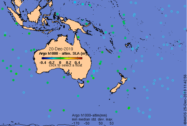
Click on the map below or choose a [WMO number] to see the temperature and salinity data from the selected float compared with satellite-adjusted climatology.

Depending on your settings, your browser may or may not open these links in a separate window.
If nothing seems to open, try right-click/open-in-new-window