1901741 1901810 1901834 1902033 1902077 2901345 2902788 2902790 2902794 3901122 3901160 3901244 4901553 4903196 4903199 5902343 5902365 5902380 5902399 5902400 5902401 5902413 5902428 5902452 5902483 5902489 5902502 5902503 5902506 5903653 5903663 5903824 5904109 5904277 5904339 5904350 5904422 5904535 5904554 5904612 5904622 5904652 5904737 5904804 5904806 5904826 5904828 5904897 5904929 5904930 5905004 5905028 5905029 5905039 5905129 5905177 5905193 5905247 5905331 5905384 5905387 5905398 5905406 5905410 5905417 5905431 5905446 5905473 5905656 5905660 5905706 5905707 5905724 5905726 5905735 5905737 5905778 5905975 5906054 5906136 5906144 5906166 5906169 5906255 5906257 5906258 5906265 5906289 5906300 5906301 5906348 5906614 5906616 5906620 6901656 6901843 6901880 6902905 6902924 6902989 6903024 7900115 7900393 7900684 7900866

Argo profiles in the Australian region

Temperature and salinity down to 2000m

[PREV] [NEXT] [DATE INDEX] [What's shown]

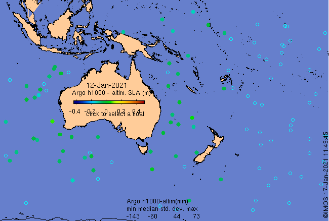
Click on the map below or choose a [WMO number] to see the temperature and salinity data from the selected float compared with satellite-adjusted climatology.

Depending on your settings, your browser may or may not open these links in a separate window.
If nothing seems to open, try right-click/open-in-new-window