1901811 1901831 1901838 1902049 1902265 2901347 2902221 2902594 2902780 2902796 2902797 2902807 2902809 2902819 3901904 4902906 5902344 5902348 5902378 5902387 5902430 5902431 5902432 5902458 5902469 5902505 5903622 5903657 5903676 5903971 5904052 5904059 5904356 5904357 5904358 5904362 5904370 5904372 5904376 5904381 5904435 5904510 5904536 5904607 5904618 5904623 5904628 5904631 5904641 5904674 5904787 5904793 5904810 5904915 5905172 5905178 5905237 5905262 5905304 5905371 5905386 5905390 5905393 5905401 5905402 5905418 5905433 5905434 5905441 5905475 5905635 5905646 5905664 5905665 5905710 5905712 5905713 5905722 5905770 5905875 5905876 5905879 5905966 5905997 5906062 5906120 5906138 5906142 5906148 5906174 5906176 5906273 5906300 5906301 5906361 5906408 5906409 5906410 5906411 5906413 5906624 6902909 6902985 6903767 6903768 6903771 7900111 7900615 7900633 7900648 7900649 7900796 7900797 7900798 7900905

Argo profiles in the Australian region

Temperature and salinity down to 2000m

[PREV] [NEXT] [DATE INDEX] [What's shown]
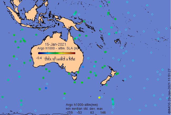
Click on the map below or choose a [WMO number] to see the temperature and salinity data from the selected float compared with satellite-adjusted climatology.

Depending on your settings, your browser may or may not open these links in a separate window.
If nothing seems to open, try right-click/open-in-new-window