1901741 1901800 1901811 1901813 1902049 1902050 1902266 2902804 2902806 2902809 2902819 4903190 4903191 4903199 5902348 5902352 5902391 5902394 5902406 5902413 5902415 5902416 5902434 5902467 5902473 5902476 5902477 5902483 5902488 5902489 5902502 5904554 5904622 5904624 5904737 5904795 5904801 5904814 5904820 5904829 5904996 5905026 5905114 5905128 5905168 5905331 5905384 5905385 5905400 5905403 5905416 5905417 5905446 5905461 5905490 5905491 5905492 5905658 5905682 5905712 5905713 5905735 5905737 5905769 5905770 5905772 5906091 5906115 5906138 5906139 5906140 5906142 5906148 5906166 5906169 5906219 5906289 5906348 5906370 5906373 5906466 5906508 5906632 5906637 5906641 5906665 5906667 5906668 5906699 5906700 5906701 5906711 5906725 6901656 6902924 6902989 6903814 7900111 7900612

Argo profiles in the Australian region

Temperature and salinity down to 2000m

[PREV] [NEXT] [DATE INDEX] [What's shown]
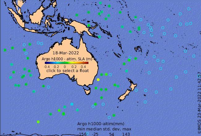
Click on the map below or choose a [WMO number] to see the temperature and salinity data from the selected float compared with satellite-adjusted climatology.

Depending on your settings, your browser may or may not open these links in a separate window.
If nothing seems to open, try right-click/open-in-new-window