
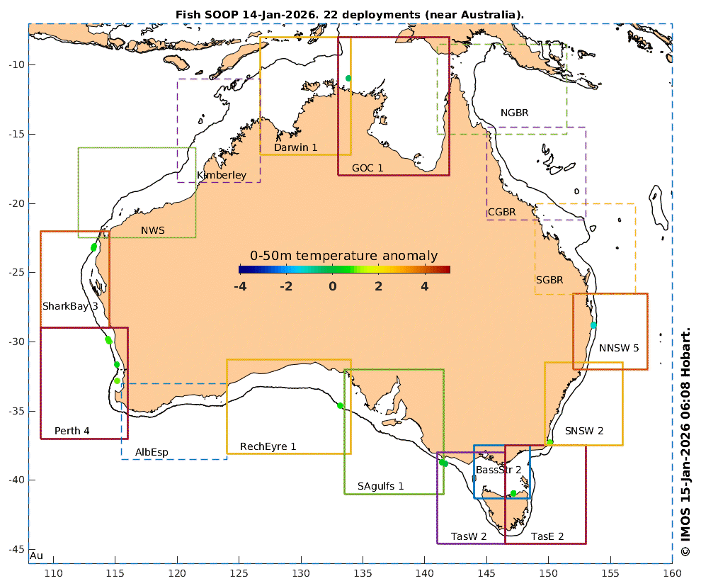
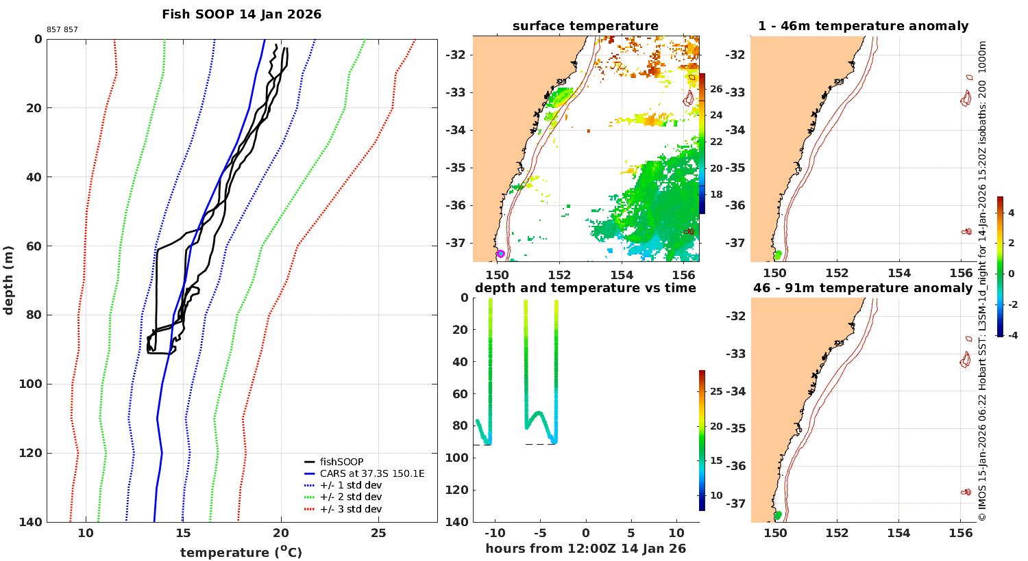
| Daily data finder maps (below) help you find plots of..... | .....temperature vs depth, time and location: |
|---|
 |
 |
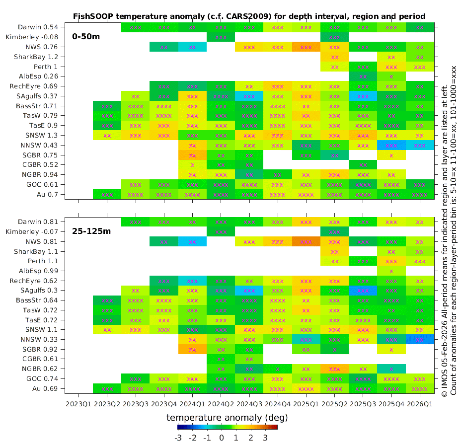
| 3-month averages of the whole FishSOOP dataset compared with a historical climatology reveals how the ocean has changed. Click for more depth layers. (The plots also show the data coverage history.) |
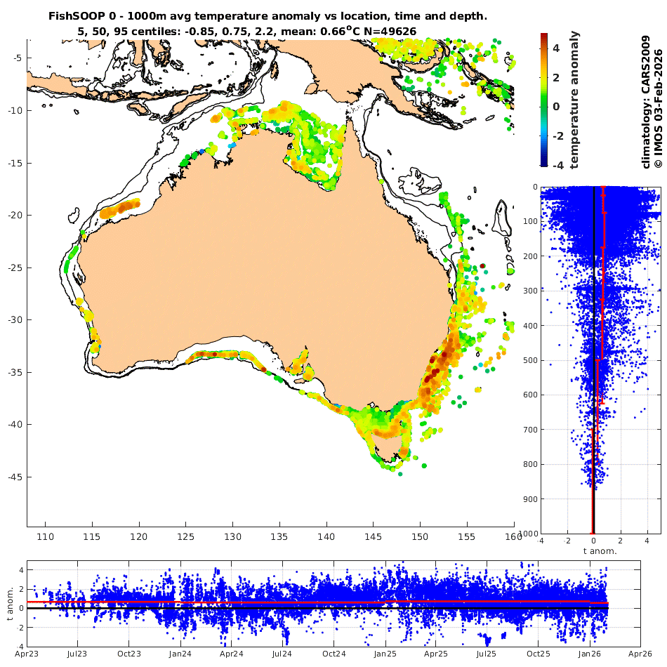
Click image below then step through regions and depth layers to explore the spatial-, temporal- and depth-dependence of the anomalies |
|---|
 |
 |
© 2026 IMOS
Use of this web site and information available from it is subject to our
[Conditions of use]