El Nino Brewing
24 April, 2015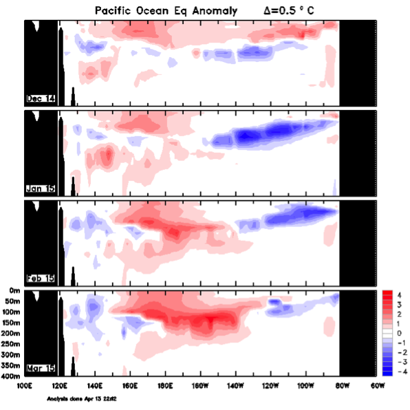
In the March-April-May period it is difficult to reliably predict the upcoming ENSO phase (known as the Spring Persistence Barrier) until sometime in June or July. Nevertheless, all the signs are there.
The big indicator for an upcoming El Nino is warmer than average temperatures along the equatorial thermocline. This is a necessary, but not sufficient, condition for an El Nino to develop. March subsurface temperatures from the Bureau of Meteorology appear to be 4°C above average in the central Pacific. What we are waiting for now is to see if the atmosphere will couple to the ocean to kick off the event. Often this can occur when a Madden Julian Oscillation (MJO) develops over the western Pacific creating a downwelling equatorial Kelvin wave, and giving the already deepened thermocline an extra push.
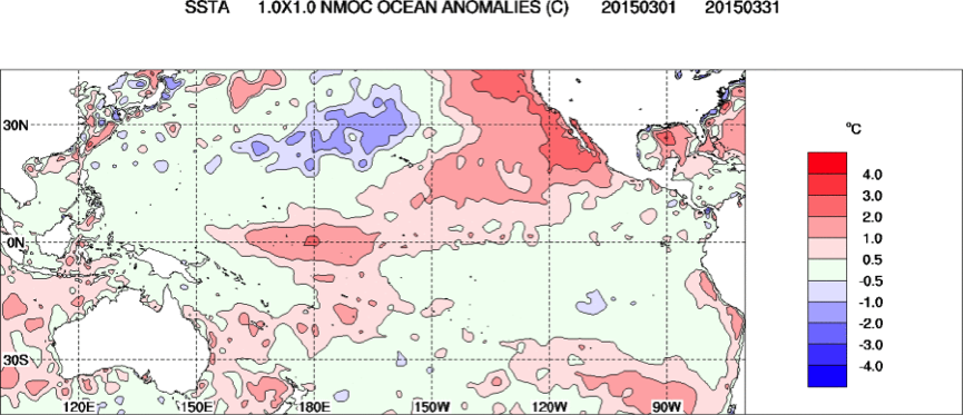
Warm Sea Surface Temperature anomalies are also appearing, but only in the central Pacific. Typical El Nino events require a warming in the eastern Pacific as well. Recently however the 'central-Pacific' type El Ninos have appeared where the warming is primarily in the central regions.
On a cautionary note, very similar conditions appeared in April of 2014 and El Nino events were predicted with a 70% chance of occurring. The warm anomalies dissipated however, though the reasons why are still being explored.