1901757 1901809 1901812 1901899 1902055 2902242 2902300 2902793 2902795 2902801 2902854 3901647 4903390 5902368 5902369 5902378 5902392 5902414 5902420 5902431 5902432 5902435 5902472 5902475 5902480 5902486 5902487 5902499 5904199 5904358 5904372 5904587 5904613 5904629 5904634 5904704 5904717 5904790 5904797 5904800 5904816 5904863 5904946 5905011 5905041 5905108 5905188 5905195 5905211 5905237 5905246 5905298 5905336 5905343 5905399 5905404 5905423 5905436 5905465 5905471 5905642 5905653 5905667 5905683 5905684 5905685 5905720 5905721 5905725 5905728 5905763 5905965 5906037 5906075 5906149 5906151 5906171 5906235 5906238 5906253 5906254 5906270 5906349 5906406 5906615 5906623 5906646 5906650 5906719 5906720 6902905 6903025 6903791 7900111 7900615 7900617 7900910

Argo profiles in the Australian region

Temperature and salinity down to 2000m

[PREV] [NEXT] [DATE INDEX] [What's shown]
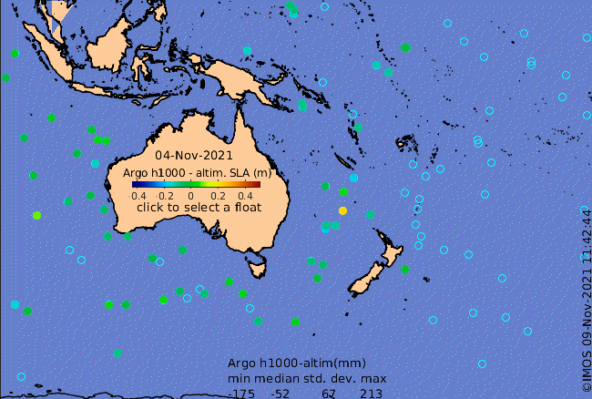
Click on the map below or choose a [WMO number] to see the temperature and salinity data from the selected float compared with satellite-adjusted climatology.

Depending on your settings, your browser may or may not open these links in a separate window.
If nothing seems to open, try right-click/open-in-new-window