1901831 1901832 1901838 1902260 1902261 1902339 2902221 3901877 3902358 3902359 3902367 4902906 5902399 5902414 5902427 5902429 5902472 5902480 5902488 5902490 5904381 5904607 5904637 5904745 5904794 5904805 5904818 5905168 5905193 5905304 5905389 5905390 5905418 5905426 5905452 5905470 5905484 5905486 5905487 5905504 5905506 5905526 5905643 5905684 5905721 5905723 5905779 5905877 5905965 5905974 5906103 5906108 5906118 5906174 5906176 5906254 5906263 5906300 5906303 5906398 5906406 5906427 5906442 5906464 5906474 5906545 5906625 5906627 5906630 5906699 5906725 5906737 5906744 5906746 5906913 5906916 6901983 6902778 6902857 6902909 6902942 6902985 6903024 7900111 7900613 7900649 7900805 7900830 7900837 7900864 7900909 7900921 7900932 7900933 7900936 7900937 7900950

Argo profiles in the Australian region

Temperature and salinity down to 2000m

[PREV] [NEXT] [DATE INDEX] [What's shown]
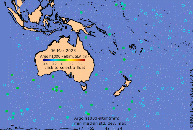
Click on the map below or choose a [WMO number] to see the temperature and salinity data from the selected float compared with satellite-adjusted climatology.

Depending on your settings, your browser may or may not open these links in a separate window.
If nothing seems to open, try right-click/open-in-new-window