2901346 2901520 2902738 2902782 2902783 2902785 2902791 3901122 3901899 4903027 5902344 5902364 5902369 5902378 5902387 5902390 5902392 5902422 5902425 5902430 5902431 5902432 5902450 5902453 5902454 5902475 5902481 5902482 5902506 5903701 5903971 5904199 5904247 5904351 5904372 5904391 5904435 5904496 5904505 5904507 5904525 5904567 5904568 5904605 5904622 5904624 5904642 5904674 5904723 5904732 5904733 5904738 5904801 5904804 5904814 5904820 5904890 5904925 5904927 5904942 5904996 5905015 5905024 5905027 5905129 5905168 5905176 5905210 5905215 5905217 5905267 5905289 5905293 5905356 5905384 5905385 5905400 5905406 5905410 5905413 5905457 5905459 5905474 5905477 5905482 5905649 5905656 5905677 5905688 5905706 5905707 5905708 5905724 5905726 5905778 5906136 5906140 5906144 5906145 5906146 5906147 5906148 5906222 5906258 5906261 6902701 6902859 6903024 6903025 6903214 7900111 7900394 7900621 7900793

Argo profiles in the Australian region

Temperature and salinity down to 2000m

[PREV] [NEXT] [DATE INDEX] [What's shown]
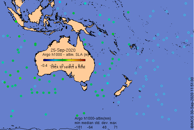
Click on the map below or choose a [WMO number] to see the temperature and salinity data from the selected float compared with satellite-adjusted climatology.

Depending on your settings, your browser may or may not open these links in a separate window.
If nothing seems to open, try right-click/open-in-new-window