1901810 1901832 1902249 1902339 2902221 2902812 2903450 2903451 4902906 5902426 5902430 5902470 5902481 5902486 5902495 5902497 5902499 5902524 5904381 5904607 5904745 5904794 5904805 5904811 5904818 5904825 5905238 5905295 5905304 5905331 5905387 5905389 5905418 5905426 5905470 5905484 5905486 5905487 5905504 5905506 5905511 5905543 5905544 5905642 5905708 5905724 5905772 5905773 5905779 5905787 5905877 5906119 5906120 5906137 5906144 5906146 5906174 5906176 5906209 5906229 5906251 5906254 5906300 5906303 5906398 5906414 5906428 5906442 5906457 5906466 5906476 5906580 5906620 5906629 5906728 5906746 5906908 5906927 5906931 5906933 5906934 6901983 6902777 6902778 6902856 6902909 7900627 7900649 7900829 7900835 7900838 7900839 7900906 7900909 7900937

Argo profiles in the Australian region

Temperature and salinity down to 2000m

[PREV] [NEXT] [DATE INDEX] [What's shown]
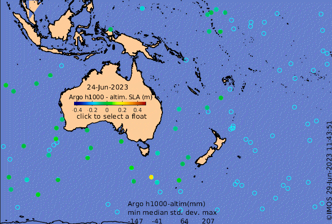
Click on the map below or choose a [WMO number] to see the temperature and salinity data from the selected float compared with satellite-adjusted climatology.

Depending on your settings, your browser may or may not open these links in a separate window.
If nothing seems to open, try right-click/open-in-new-window