1901831 1902054 1902199 2902798 2902894 2903453 2903854 2903856 3902210 3902361 3902363 4903176 4903385 4903630 5902449 5902486 5902490 5902500 5904610 5904640 5904651 5904972 5905212 5905239 5905242 5905247 5905319 5905333 5905353 5905416 5905444 5905448 5905499 5905532 5905538 5905542 5905668 5905714 5905715 5905765 5905780 5905966 5906108 5906140 5906152 5906165 5906191 5906258 5906259 5906264 5906265 5906268 5906269 5906286 5906301 5906318 5906346 5906415 5906423 5906425 5906462 5906579 5906635 5906650 5906675 5906699 5906701 5906725 5906736 5906737 5906795 5906844 5906920 5906934 6902938 6902985 7900679 7900805 7900811 7900828 7900895 7900938 7900952 7900953 7901094

Argo profiles in the Australian region

Temperature and salinity down to 2000m

[PREV] [NEXT] [DATE INDEX] [What's shown]
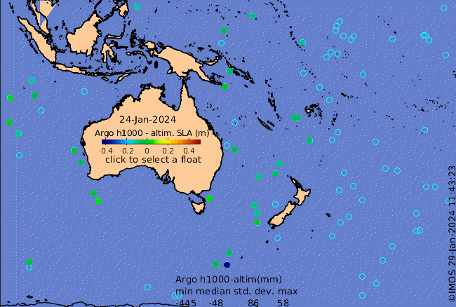
Click on the map below or choose a [WMO number] to see the temperature and salinity data from the selected float compared with satellite-adjusted climatology.

Depending on your settings, your browser may or may not open these links in a separate window.
If nothing seems to open, try right-click/open-in-new-window