1901831 1902045 2903854 3902256 3902362 4903388 5902489 5904654 5904739 5904807 5904811 5904816 5904817 5904818 5905115 5905203 5905206 5905293 5905304 5905388 5905404 5905426 5905464 5905470 5905484 5905531 5905532 5905542 5905562 5905566 5905570 5905573 5905575 5905576 5905649 5905656 5905663 5905703 5905704 5905712 5905761 5905764 5905871 5906013 5906075 5906136 5906149 5906255 5906285 5906368 5906411 5906414 5906424 5906462 5906550 5906579 5906636 5906646 5906654 5906697 5906701 5906737 5906767 5906771 5906846 5906889 5906890 5906893 5906920 6901983 6902909 6902920 6902939 6902941 7900679 7900805 7900905 7900914 7901094 7902023

Argo profiles in the Australian region

Temperature and salinity down to 2000m

[PREV] [NEXT] [DATE INDEX] [What's shown]
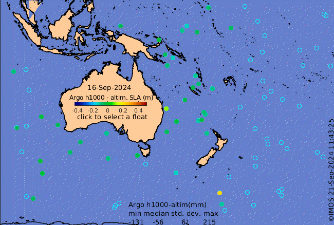
Click on the map below or choose a [WMO number] to see the temperature and salinity data from the selected float compared with satellite-adjusted climatology.

Depending on your settings, your browser may or may not open these links in a separate window.
If nothing seems to open, try right-click/open-in-new-window